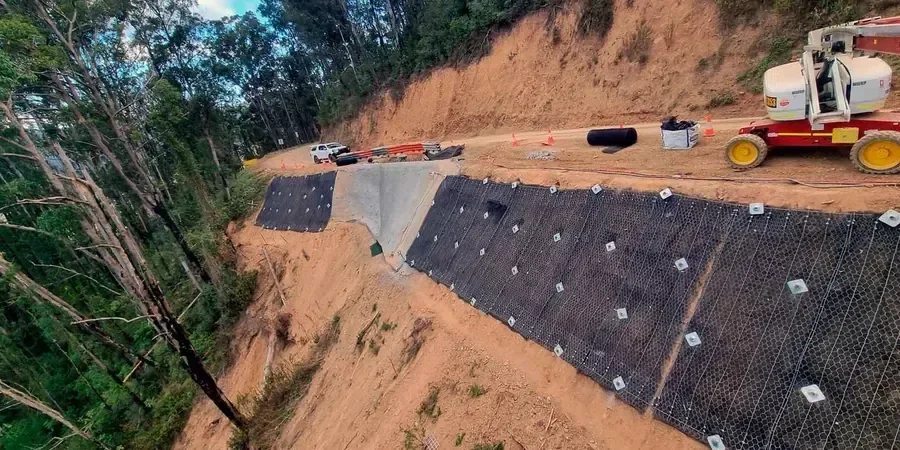
Wigan sits on a complex legacy of shallow coal workings, glacial till and the steep-sided valleys of the Douglas and Leeds-Liverpool canal corridor, where even a modest cutting can mask a deeper instability inherited from nineteenth-century mining. We regularly see ground that looks competent at surface but fails within the weathered zone once pore pressures rise after sustained rainfall. A desk study alone is not enough here. Our approach to slope stability analysis starts with careful geomorphological mapping, then moves to targeted intrusive investigation and laboratory strength testing that reflects the real in-situ conditions, particularly within the Pennine Middle Coal Measures that underlie much of the borough.
We have supported residential developments on the former Pemberton colliery fringe, canal-side retaining works near Wigan Pier and highway embankment assessments along the A49, where the combination of made ground, natural clay and fluctuating groundwater demands a factor of safety that accounts for progressive failure mechanisms rather than assuming a homogeneous slope. This is not generic software output; it is a site-calibrated assessment that recognises how Wigan's geology behaves when saturated, unloaded or subjected to vibration from heavy rail freight on the West Coast Main Line corridor that cuts through the eastern edge of the town. Where the ground profile suggests a risk of deep-seated movement, we frequently couple the analysis with inclinometer monitoring to verify the actual slip surface depth before committing to a remediation design.
A slope that has stood for fifty years can fail in one wet winter if the pore pressure regime changes faster than the ground can drain.
Process overview
The field phase for a Wigan slope stability assessment typically begins with a tracked dynamic sampler or windowless sampling rig that can access the narrow colliery access tracks and overgrown embankment toes that characterise the borough's post-industrial landscape. We target the interface between the glacial till and the weathered mudstone, extracting undisturbed samples for multi-stage triaxial testing under consolidated-undrained conditions with pore pressure measurement, which gives us the effective stress parameters that Eurocode 7 Design Approach 1 requires.
Back in the laboratory, the testing programme follows BS EN ISO 17892-9 for triaxial compression and BS EN ISO 17892-12 for residual strength using the Bromhead ring shear apparatus, essential when we suspect a pre-existing shear surface in a relict landslide. The groundwater regime is monitored with standpipe piezometers installed across the slope profile over at least one winter season, because Wigan's annual rainfall of roughly 900 mm concentrated between October and February often reveals a perched water table within the head deposits that a summer investigation would completely miss. All data feeds into limit-equilibrium modelling using Spencer or Morgenstern-Price methods, with sensitivity analyses run for partial drainage, toe excavation and seismic loading per UK National Annex to BS EN 1998-5.
Local context
Wigan's population of roughly 330,000 lives across a landscape where the 1868 West Lancashire Mining District map shows shafts every few hundred metres, and many of these were backfilled with colliery spoil that has been slowly consolidating for over a century. The biggest geotechnical risk is not the obvious steep slope but the hidden crown hole or unrecorded bell pit that can trigger a retrogressive failure when surface water infiltrates the backfill and reduces suction. Prolonged wet winters, such as the 2015-2016 period that caused widespread flooding across Greater Manchester and Lancashire, have repeatedly demonstrated that slopes previously considered stable can mobilise along a softened clay layer that was not detected during a dry-summer investigation. Our analysis explicitly checks for the presence of high-plasticity clay bands using Atterberg limit testing on every recovered sample, because a thin seam of glaciolacustrine clay with a liquid limit above 60 percent can control the entire failure mechanism even when it is only a few millimetres thick. Where mining records are incomplete, we integrate non-intrusive geophysics to map void anomalies before the slope stability model is finalised.
Quick answers
What are the warning signs that a slope in Wigan might be unstable?
The indicators are often subtle before a failure accelerates. Look for tension cracks parallel to the crest, particularly after a dry spell when clay shrinks and opens fissures that later fill with rainwater. Tilting fence posts or retaining walls that have rotated outward by more than a few degrees suggest creep movement. Patches of rushes or willowherb on an otherwise dry slope often mark a seepage zone where groundwater exits the face. In Wigan specifically, a circular depression in grassland can indicate a crown hole from collapsed mine workings rather than a shallow landslide, and the two need very different treatment, so a Coal Authority report should always be the first check.
How long does a slope stability investigation take?
A thorough assessment in the Wigan area typically runs between eight and twelve weeks from instruction to final report. The field investigation itself takes one to two weeks depending on access constraints, but the critical path is usually the groundwater monitoring, which needs to capture at least one wet season to give meaningful pore pressure data. Laboratory triaxial testing adds roughly four weeks because the consolidated-undrained tests require slow shearing to allow accurate pore pressure measurement. If the slope is showing active movement, we can issue an interim hazard assessment within two weeks to guide immediate safety measures while the full analysis continues.
What does a slope stability analysis cost in Wigan?
For a typical single-slope assessment in the Wigan area, including a desk study, intrusive investigation with dynamic sampling, laboratory triaxial and ring shear testing, piezometer installation with three months of monitoring, and a limit-equilibrium analysis report, the fee ranges from £1,040 to £3,010 depending on slope height, access difficulty and the number of monitoring points required. Larger sites with multiple slope faces or complex mining legacy issues fall at the upper end of that range, and any remediation design beyond the stability analysis is priced separately based on the specific measures recommended.
Can you model the effect of mine workings on slope stability?
Yes, this is one of the most common scenarios we encounter in Wigan. We incorporate the geometry of known workings, including shaft location, seam depth and extraction method, into the slope model so that potential crown hole collapse or pillar failure can be assessed as a triggering mechanism. Where the Coal Authority records are incomplete, we combine electrical resistivity tomography or microgravity surveys to locate void anomalies before integrating them into the stability analysis. The modelling can then test how a void migration to surface would affect the factor of safety of an adjacent slope or cutting.